New Marine Debris Visualization Interface

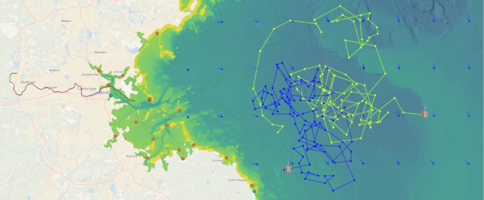
MIT Sea Grant has developed a new marine debris visualization interface with interactive tools for exploring the flow of debris from land to ocean.
This new interface is a product of the project, “Massachusetts Marine Debris From Source to Stellwagen: A Comprehensive Suite of Tools for Environmental Educators“, which addresses marine debris across the “lifetime” of debris.
>>Visit the interface + click “Quickstart”
Developed through collaboration with Stonehill College, the Cohasset Center for Student Coastal Research, and a coalition of K-12 educators and students, environmental organizations, communities, and commercial fishermen, the interface presents the flow of debris as a series of steps. Each step includes at least one visualization tool:
- Where do we find debris on land?
- Visualize Debris
- Where might it have come from?
- Draw A Watershed
- How could it find its way to the ocean?
- Trace Debris Downstream
- Once in the ocean, where might it go?
- Visualize Drifters
- Visualize Currents
- Visualize Sea Surface Temperature
The interface includes sections describing the basic steps to visualize data, a summary of connected data sources and map layers, and a summary of map tools. It was developed using MIT Sea Grant’s Seaglass framework for network-based data visualization.
To explore the interface, go to: https://gisviz-mit-edu.ezproxy.canberra.edu.au/marine-debris/ and click the “Quickstart” button at the bottom of the page for comprehensive guidance.
Questions?
For more information about the interface, contact:
Ben Bray (bbray@mit.edu)
Geospatial Applications Developer, MIT Sea Grant
For more information about this project, contact:
Dr. Kristin Burkholder, Ph.D. (kburkholder@stonehill.edu)
Associate Professor of Environmental Science, Stonehill College
Jack Buckley (jbuckley@ccscr.org)
President, Cohasset Center for Student Coastal Research
Dr. Andrew Bennett (abennett@mit.edu)
Education Administrator, MIT Sea Grant


